PADDLEBOARD FROM SUMNER TO CASS BAY
- Jo Taylor

- Nov 24, 2024
- 4 min read
Updated: Jun 19, 2025
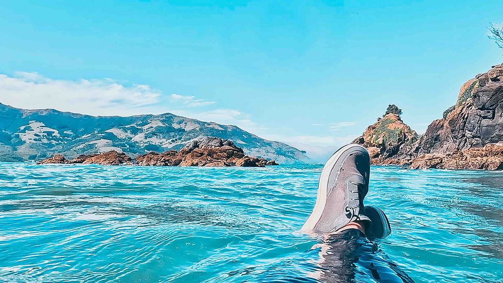
If you want to paddleboard in Christchurch, this one way paddle passes the most spectacular coastline, paddling past breathtaking bays and towering cliffs. It's not one for beginners, with some rolling swell expected in the exposed sections, so grab a friend, set up your shuttles and head out on a 16km adventure! I joined my friends Nick and Sarah who live in Christchurch, and we headed to the beach with my SUP and their sea kayaks!
Paddleboarding IN CHRISTCHURCH ON THE SEA
Your paddle begins at Sumner Beach, a popular spot for surfers and beachgoers just 12 km from Christchurch city centre. Sumner is a long sandy beach that gets good waves (so make sure you come back for a surf or SUP surf here), and it's an excellent starting point due to how easy it is to park up and launch here. There is a real buzz here of locals loving their beach, and a good community vibe, I would love to have stayed and caught some waves!
You will be heading westward, skirting around Scarborough Hill, so we launched from the west end of the beach, up by the Scarborough Lifeboat station as this is more sheltered from the waves and closer to access at low tide. Try not to do what I did, which was be so enthusiastic to get on the water that I tripped over a rock and face-planted on the sand, throwing my board into the water. Buoyancy aids do really cushion a fall though, so I bounced back up and on to the water!
The Scarborough headland is stunning. with dramatic cliffs, and once you get round, you head into the bay, Taylors Mistake – another great surf spot in Christchurch. And one with the best name ;) This bay is also a great place to pause, explore, use the loo and enjoy the pretty beach here. However, it is a surf beach so waves are common here and landing can be tricky, as Sarah found out, ending up rather wet. Legend has it that the name comes from Captain Taylor, who mistakenly believed the bay was the entrance to Lyttelton Harbour.
As you carry on past the rugged cliffs at Godley Head, you can wave to walkers out on the hillside tracks and explore caves along the way. A true highlight of this route, Godley Head is perched on the easternmost tip of the Port Hills and offers a glimpse into military history. Atop Godley Head lies the Godley Head Coastal Defence Battery, a key part of New Zealand's WWII coastal defences, where gun emplacements and tunnels still remain. This part of the paddle is exposed, so expect swell and be careful navigating around the rocks.
Whilst Sarah was suffering from a badly timed period of sea sickness in her kayak, I was happily being followed by a Hector dolphin as I paddled around the headland into Lyttelton Harbour, where the water is calmer and more sheltered (in general, but wind dependent!). Lyttelton Harbour was formed by volcanic activity around 11 million years ago, and this section gives you beaut views of the Port Hills to the north, the Banks Peninsula to the south and Quail Island in front of you. If you have time, Quail Island would make a great stop to visit, camp or stay at the hut here, and this would add about 5km to your trip.
Once you cross the busy entrance into Lyttelton Harbour (take care as ships move fast), you will wiggle past Corsair Bay (gorgeous) and head into the sleepy, pretty Cass Bay. The small beach at Cass Bay is a great landing point, with parking at the waterfront and facilities to use. Don't do what I did (again!) and come back to a flat battery from leaving your lights on in the car. But it wouldn't be a day out without Jo forgetting something!

route
PADDLING INFO for sumner to cass bay
RATING |
|
ROUTE & conditions |
|
WHERE TO PARK & LAUNCH |
|
WHERE TO EAT & DRINK |
|
WHERE TO SLEEP |
|
LOCAL INFO |
|
WEATHER and tides
I use Windy, Wind Finder, Met Service and NIWA check the weather, wind and swell.
Download the tides a year ahead from Land Information New Zealand.
Until next time, happy paddling!


Comments