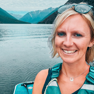
PADDLE TO THE HISTORIC NELSON LIGHTHOUSE
- Jo Taylor
- Jun 19, 2025
- 5 min read
Updated: Jun 19, 2025
I absolutely love this paddle out to the Nelson Lighthouse on the Boulder Bank for so many reasons. The view from the top of this historic lighthouse are absolutely amazing on a clear day. 360 degree views of the Nelson Haven, the boulder bank, Tasman Bay, the Western Ranges, Haulashore Island and looking back into the town of Nelson.

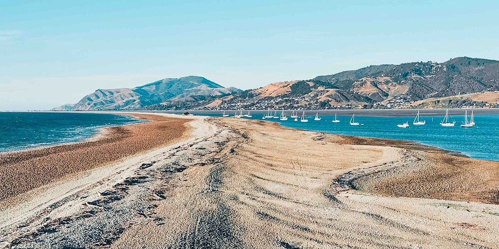
From the top of the lighthouse, you can really appreciate the scale and uniqueness of the boulder bank - the only formation in the world of its kind. If you look into local Māori stories and legends, the Boulder Bank features a lot as it holds cultural significance to Māori people. Spanning 13km long from Glenduan to the end, this natural spit is formed by longshore drift over ten thousand years, building up boulders from the seabed. It is the largest natural reef in the Southern Hemisphere - how cool is that! But it also acts as a natural breakwater to protect Nelson's harbour and port.
The Nelson Lighthouse was the second permanent lighthouse in New Zealand (after Wellington), erected in 1861. The lighthouse was actually made from cast iron in Bath, England and then shipped in parts all the way here. It is now a Category 1 historic place with Heritage New Zealand. The lighthouse is in excellent condition, but the internal staircase is very steep, narrow and low in height so do be careful. You have to crawl through this small gate at the top to get out to the viewing platform. Sitting at 18m high, maybe sit this one out if you don't like heights!
The Kidson family lived at the lighthouse acting as lighthouse keepers for over 30 years. They raised 12 children on the Boulder Bank, who were rowed across the harbour every day so they could attend school. The buildings around the lighthouse where they lived are no more except for the foundations, but photos in the lighthouse show the wonderful house they lived in. John Kidson even imported soil so he could grow a garden on the Boulder Bank.

The lighthouse was critical in helping ships navigate a narrow and curved harbour entrance through the Cut that has a 4m tidal range, and can be quite dangerous. The light was once extinguished in 1942 amidst fears of a Japanese invasion during the war. It was the longest operating lighthouse in New Zealand, decommissioned in 1982 and replaced with a shore based light. I love that you are able to collect the lighthouse key and visit this special spot on your own, and appreciate its beauty and history.
This is an awesome 4km round trip paddle from the Seaford Marine Rescue Centre, heading towards Haulashore Island, then across the shipping lane and along the protected inward haven side of the Boulder Bank. Check the depth of the water along here as it's very tidal with sand features, so you don't catch your fin where it gets shallow. Make sure you pull your board up away from the waterline on an incoming tide when you head off to explore. Take shoes as the bank is very rocky, and then go and explore the Boulder Bank! Expect lots of seagulls, oystercatchers and shags and you might spot some seals over the Cut.
Avoid paddling close to the Port as this is where there will be increased harbour activity and hazards to navigate. You could make this paddle longer by launching from Tahunanui beach instead, but this will need more planning with the tides to make this a successful trip. See notes below for planning this route with the tides.
Once you have soaked up the views, head back the way you came. If you don't want to head here on your own, you can join a guided paddle trip with Paddle Nelson, or take the Nelson Ferry over, or walk along the Boulder Bank from Atawhai.
Route

INFO for paddling to the nelson lighthouse
RATING |
|
ROUTE & conditions |
|
WHERE TO PARK & LAUNCH |
|
WHERE TO EAT & DRINK |
|
WHERE TO SLEEP |
|
LOCAL INFO |
|
WEATHER & TIDES
I use Windy, Wind Finder, Met Service and NIWA check the weather, wind and swell.
Download the tides a year ahead from Land Information New Zealand.
Nelson is where I call home in New Zealand so do shout if you come up this way, and come and say hi!
Until next time, happy paddling!


Comments