PADDLE THE WAIMAKARIRI RIVER
- Jo Taylor
- Dec 1, 2024
- 4 min read
Crisp cold sunny days on the water are the best when you’re treated to places like this! 🤩
Waimakariri means “cold water” in te reo Māori, a fitting name for the glacier-fed river that flows from the Southern Alps to the Pacific Ocean. The clear, blue Waimakariri River is an absolute stunner, braiding its way through the Canterbury plains framed by the snow topped mountains.
The river is a lifeline for Christchurch and Canterbury, providing irrigation for farms and drinking water for the region’s cities and towns and boy is it an awesome paddle!
New Zealand is filled with so many incredible paddle spots, but finding paddle info can sometimes be hard. Trusting golden oldies like our 1995 South Island Rivers guide book worked a treat here. Doing our own research, asking locals, plotting our paddle on @ordnancesurvey, and checking the water levels before we went… and she was good to go.
Paddle THE WAIMAKARIRI
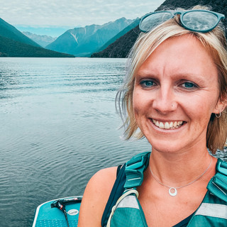
I had been wanting to get on this river and dabble back into some moving water on my SUP. I love playing around on river waves, practicing going in and out of eddies and ferry gliding on the board, but it had been a while, and you need two cars for shuttles, so I was so buzzed to go with my friends Nick and Sarah.
The Waimakariri River is one of Canterbury’s iconic braided rivers. We chose the lower section (15km) for ease of access from Christchurch to paddle in one day, but the higher stretch is 60km, well known for hosting the kayaking part of the Coast to Coast race (grade 2).
Water levels were pretty low, and this stretch, from near Woodstock Road to the Gorge Bridge, is perfect for stand-up paddleboarders looking for a fun river to paddle (mostly ungraded with some grade 1 sections). You will need to set up shuttles for this paddle, before heading to the start where you can drive onto the gravel river bed and launch into the flow. I wasn't sure my van was going to make it down on the rough track, but we survived, then we got pumping! Three boards to inflate, lunch to pack and drysuits to pop on, and finally we were ready!
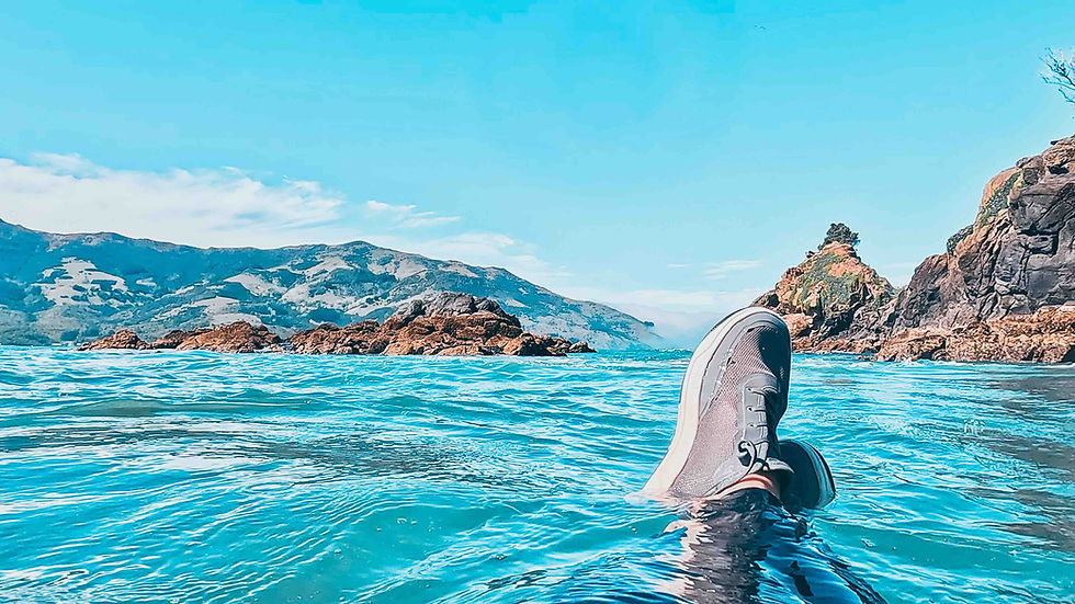
Your starting point is just off Woodstock Road, near Oxford, where the river's braids begin to spread out. As you launch your SUP into the clear blue waters, you’ll notice the landscape become rugged and wild. The river alternates between braided sections, where you’ll need to choose your path down the deeper, more defined channels, picking the line with the fastest flow.
Although it was a cold day around 5 degrees, that sun was strong and I was cooking in my drysuit so some jumps in the water was necessary! We had lots of eddies to play in along the way, a few sections to wade through where it was rather shallow, and a few races of 'let's pick different braids' and see who wins!
The route ends at the Gorge Bridge, a popular spot for jet boating, rafting, and kayaking. Here, you can pull out your board after just passing under the bridge, enjoy the views. We munched down our belated lunch and discussed plans of how we would try and rescue the sheep that was stuck on a cliff just upstream around the bend and whether we could get it on a board and have the first SUP Sheep. But we decided against it in the end, and hoped he would make his own way out.

route
PADDLING INFO for the waimakariri river
RATING |
|
ROUTE & conditions |
|
WHERE TO PARK & LAUNCH |
|
WHERE TO EAT & DRINK |
|
WHERE TO SLEEP |
|
LOCAL INFO |
|
WEATHER
I use Windy, Wind Finder, Met Service and NIWA check the weather and wind.
Can't wait to paddle this river higher up through the iconic gorge later in the year.
Until next time, happy paddling!


Comments